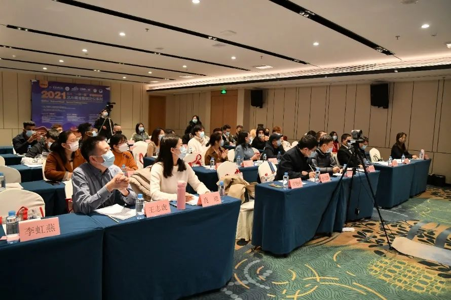
The Based on Spatial Data Special Training Course on Precise and Intelligent Positioning was successfully held in Nanning, Guangxi during January 10 to 12, 2022, and it was held under the guidance of Alliance of International Science Organizations (ANSO), International Association of Geodesy (IAG), Bureau of International Cooperation of Chinese Academy of Sciences and International Liaison Department of Chinese Association for Science and Technology. The training course aims to strengthen the application promotion and personnel training of precise and intelligent positioning technology based on special data and accelerate the cooperation between China and B&R countries in the field of precise and intelligent positioning. The three-day training course was delivered both online and offline, in a mixture of live-streaming and prerecorded modes and adhere to the concept of combining theoretical courses and interactive learning. The training course has attracted nearly 100 foreign trainees from more than 10 countries and regions, including Bangladesh, Nigeria, Zimbabwe, Rwanda, Pakistan, Nigeria, Somalia, Zambia, Chad and Ethiopia.
Prof. Ailikun, the Assistant Executive Director of the Secretariat of ANSO, Ms. XIAO Di, the Deputy Director of Academic Exchange Center of China Satellite Navigation Office, and WNAG Zhihu, the Director of China-ASEAN GNSS (Nanning) Center, was invited to attend the event and delivered speeches. The guests, experts, and related personnel at home and abroad present at the ceremony included ZHANG Weijiao, the First-level Principal Staff Member of Foreign Exchange and Cooperation Division of Guangxi Department of Science and Technology, YAN Yifeng, the Chief of Exit-Entry Administration Division of Nanning Foreign Affairs Office, ZHOU Yanxian, the Dean of College of International Education of Guangxi University for Nationalities, SONG Zhaozhen from School of International Exchange of Guangxi International Business Vocational College, MAO Weichen, the Director of International Cooperation Department of Norinco Norla Institute of Technical Physics Guangxi Branch.
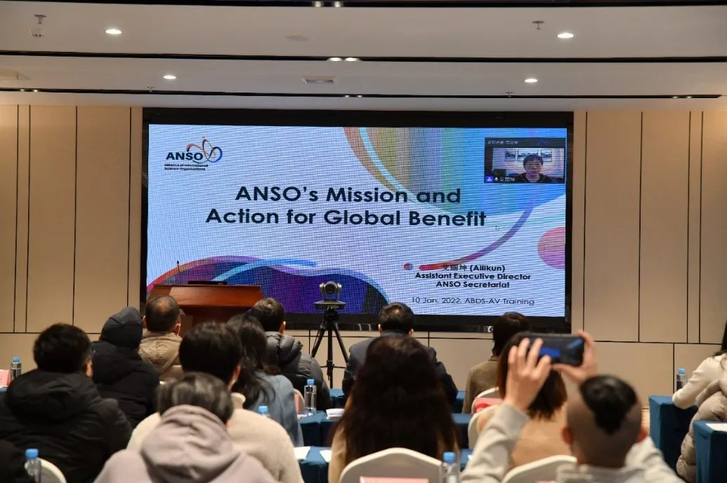
In Ailikun’s online speech, she introduced in detail the positioning and missions, strategies and action goals, and joint deployment projects of ANSO, as well as ways for participants to participate in ANSO activities, and wished the course a great success. She also hoped that scientific communities of various countries would join hands and make joint efforts to give full play to the role of the ANSO platform and make important contributions to promoting the building of a community of common destiny for mankind.
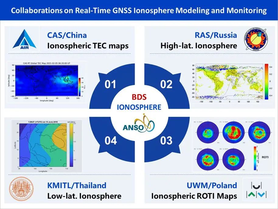
This training course is one of the main tasks of the ANSO joint research project "Advanced methodology development of global precise positioning aiming to Intelligent Driving and its demonstration over B&R". Dr. WANG Ningbo from the Institute of Aerospace Information Innovation, Chinese Academy of Sciences, on behalf of the project team, has focused on training the key technology of precision positioning service platform, which covers the areas and regions over B&R, and the application cases of the platform in smartphones and unmanned vehicles. In addition, Dr. SHEN Jun, Chief Scientist of Beijing UniStrong Science and Technology Co., Ltd. and Professor WU Caicong, China Agricultural University, systematically taught the students from the overview of the GNSS and the application of GNSS precision agriculture. During the training, the students investigated and studied the China ASEAN GNSS (Nanning) center and the key GNSS application demonstration project in Nanning, and experienced the driverless tractor sugarcane seedling transplanting and unmanned farming.
The training course improved the understanding of participants among ASEAN students on spatial data represented by satellite navigation and played an important role in strengthening the innovative application of spatial data and promoting the application and promotion of precise and intelligent positioning technology in ASEAN countries.
Source: LI Zishen, the Institute of Aerospace Information Innovation, Chinese Academy of Sciences

 Tel: 86-10-84097121
 Email: anso-public@anso.org.cn
 Location:No.16 Lincui Road, Chaoyang District, Beijing, China